“Swiss atlas cartography – precision and innovation between snow and rock”
When: from 04. until April 06, 2025
Where: Zurich Central Library, Zähringerpl. 6, 8001 Zurich
The event is free of charge.
- A map-historical tour of the Swiss National Museum is planned. The costs incurred (guided tour, admission) are to be borne by the participants themselves.
- A final program will be published here shortly.
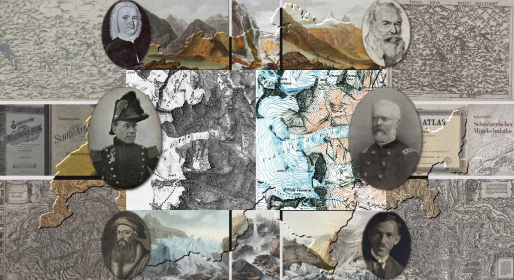
Swiss cartography has a long history: the first complete map of Switzerland was published in 1495/97 by the Zurich city physician Konrad Türst, and the first printed map on this basis, “Tabula nova Helvetiorum”, appeared as plate 17 of the Strasbourg Ptolemy edition of 1513. (Earlier depictions of places and parts of Switzerland date back to the Tabula Peutingeriana and can also be found, for example, on the Ebstorf world map, which was unfortunately destroyed during the Second World War). Johannes Stumpf’s maps, which appeared in 1547/48 in the “Chronik Gemeiner loblicher Eydgnoschafft Stetten, Landen und Völckeren thaaten beschreybung” and were published several times as an atlas from 1548 onwards, must be considered the first national atlas (of Switzerland and in general).
The development of Swiss cartography is determined on the one hand by the circumstances of the time (such as internal and external conflicts, the development of the administration, the development of tourism), and on the other hand also significantly influenced by the special geographical location. When cartographers attempted to map the mountains, they were forced to develop or rapidly adapt new forms of terrain representation in order to achieve the precision required by the mountainous shape of the land. In particular, the “Dufour Map”, the first official map of Switzerland (1845-1864) and the “Siegfried Atlas” (from 1870) should be mentioned here as milestones in the accuracy of mountain representation and artistic design.
Parallel to official cartography, private publishers (Hallwag, Kümmerly & Frey, Orell Füssli) also produced significant achievements in the fields of school, tourist and road maps, which contributed significantly to the internationally significant reputation of Swiss cartography.
As part of the Atlas Days, we will trace some of these developments in lectures and extensive examination of the map material. Due to the special characteristics of Swiss cartography, the content will not only focus on publishing cartography (the private publishers of the 19. and 20th century), but also includes aspects of early private cartography and official cartography
A guided tour of the history of maps at the Swiss National Museum rounds off the program. Among other things, the original copper plates of the Dufour Map and the St. Gallen Globe, which is also famous beyond the country’s borders, can be seen there.
The International Atlas Days are aimed at interested parties, experts and collectors of atlases with a focus on the 19. and 20th century. Cartographic and bibliophile aspects are considered in equal measure.